|
ABOUT THIS RIDE
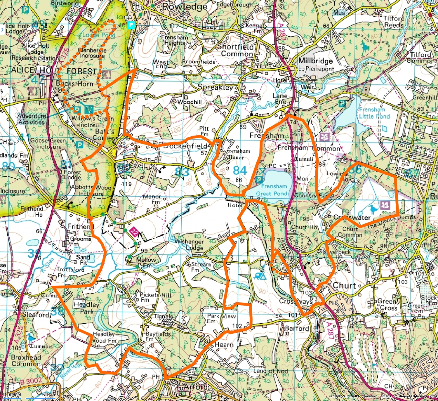
Approx 21 miles with alternatives for any of the more extreme
sections. Taking in Frensham Ponds, some great trails leading to the bike
trails at Alice Holt Forest,
The Shipwrights Way
, then some interesting trails linking up the return route.
Map of Route
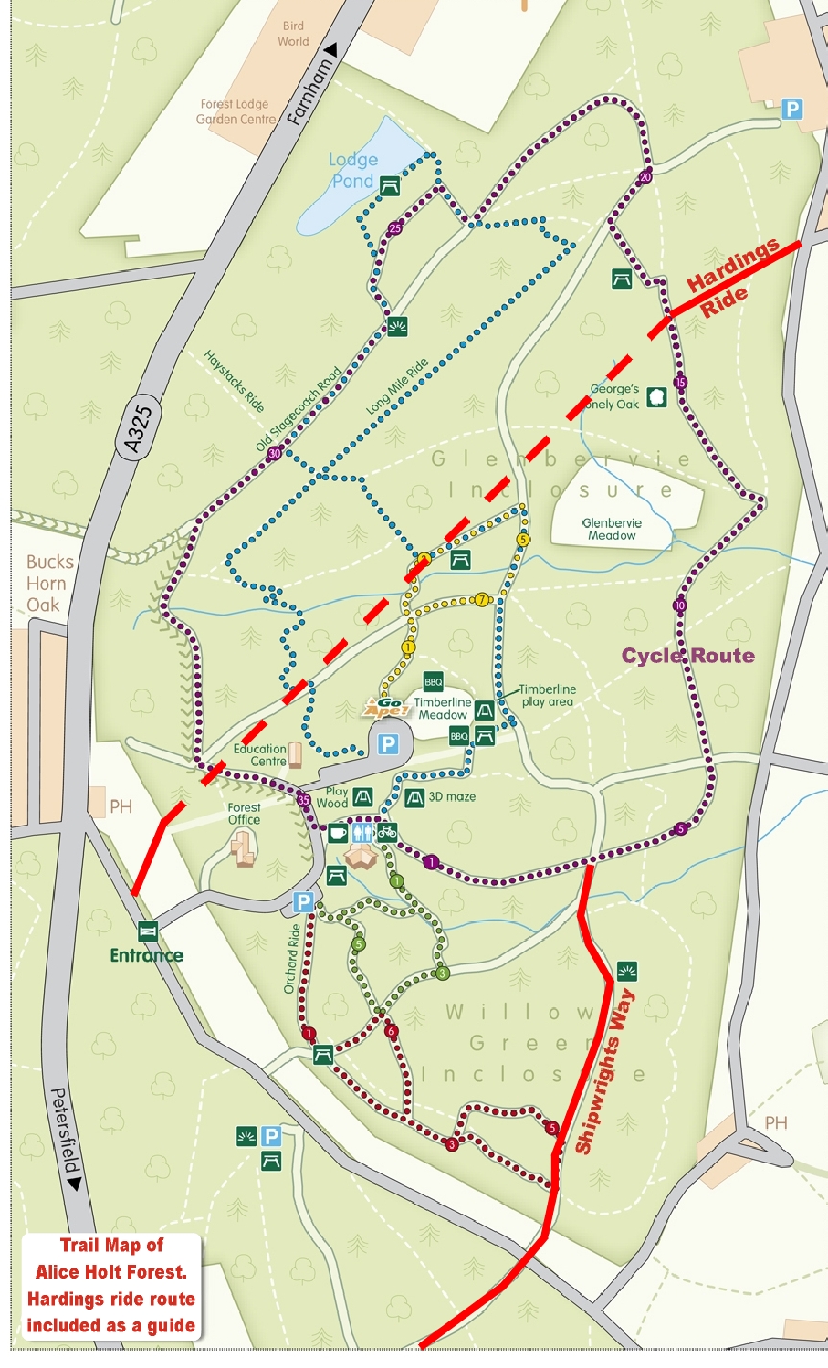
Alice Holt Trail Map
Return to home page
|
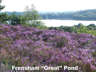
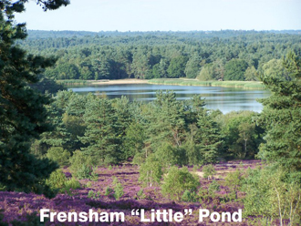
Proceed along Kings Ridge (in an approx N direction) with views of Frensham
Great Pond to your left and the Little Pond to your right.
Keep to the left
side of the ridge where the trail forks. As it starts to descend through trees,
look out for a single track to your left. Take the trail to the right of a
gulley.
.JPG)
This is a nice, short, fairly steep
descent but you will brush past gorse and holly. Cross a sandy bridleway at the
bottom and continue on the single track to the A287. CAUTION: this is a fast
road with poor sighting. Cross straight over and bear left on the minor road
which passes
FRENSHAM GREAT POND CAR PARK on your left.
At a left hand bend at the bottom of a descent the road passes close to the
lake. Here, the entrance to a bridleway leads between railings to your right.
.JPG)
.JPG)
This is an interesting single track beside Moors Pond and The River Wey.
You
may find a couple of mud patches here which can usually be bypassed. The trail
ends in the driveway of Frensham Mill.
.JPG)
.JPG)
Turn left on the road and proceed a
short distance to a T junction. Turn left here and very shortly there is a
house to your right with a bridleway entrance beside it.
.JPG)
An excellent single track leading gently uphill between fields.
.JPG)
.JPG)
Bear right at houses and continue
uphill on a short surfaced access road. At the end continue on a narrow single
track climbing through trees. At the top turn left onto a driveway, passing The
Blue Bell pub on your right before arriving at a T junction.
Turn right on the road and follow it for something over half mile. At the
bottom of the second descent there is a surfaced road to your right, but just
before it there is an easily missed byway to your left. This is Hardings Ride
and leads to Alice Holt Forest.
.JPG)
At first it has a gravel surface but after
passing through a gate you may find a mud patch which can normally be ridden
around. You will come to a trail with a hard surface crossing the byway.
This is part of the Alice Holt cycle network and here, you have a choice.
You can turn right and follow the cycle route signs. This is a pleasant
undulating ride on a hard surface for about two miles.
.JPG)
.JPG)
At marker number 20 you
will pass a trail leading off to
ROWLEDGE CHURCH CAR PARK. Continue past this
on the cycle trail which takes you past Lodge Pond (look out for a turnoff on
the right) and eventually to the
.JPG)
VISITOR CENTRECAR PARK, where there is a cafe, bike shop with rental, and
various
attractions. The
trail has an interesting descent after the Cafe and comes to a X junction at
the bottom. Turn right here. This is The Shipwrights Way. Ignore right fork and
continue uphill on the main trail.
.JPG)
.JPG)
Choosing the left turn from Hardings Ride and following the cycle route signs
is shorter and avoids the Visitor Centre. Continue straight on to the X
junction and you will see The Shipwrights Way climbing fairly steeply
to your left with the same surface as the cycle trails. It is
way-marked with small blue signs.
.JPG)
The trail crosses a road and continues through another section of Alice Holt
Forest as a conventional forest trail, mainly down hill with occasional views
towards The South Downs.
.JPG)
.JPG)
Follow the markers at a left then right turn to
another road crossing. The markers direct you a short distance to the left then
right into Cradle Lane, which is a byway. Once past a short section of access
road it becomes a nice flowing downhill, hard surfaced run to a bridge or ford
stream crossing.
.JPG)
After this the surface becomes progressively softer and horse
eroded so that a short section can become muddy, although in my experience
always rideable.
It meets a road opposite Headley Park Hotel. Turn right and follow the road for
around half a mile. The Shipwrights Way continues on a bridleway on the left.
Do not take the first wide driveway past Headley Park but continue to the brow
of the hill where a marked but easily missed single track is found. Although
there is some horse erosion it's still a great bike lane.
.JPG)
After crossing a
driveway and passing through a gate it continues through woodland, exiting at
another gate. Turn left here and continue on the main trail which becomes an
uphill farm track, ignoring a gate on your right signed for The Shipwrights
Way. At a
gate across the main trail turn right on a single track descending between
fields - slightly technical in having ruts hidden in long grass.
.JPG)
Entering a woods you are rewarded with a superb twisting descent down to an
ancient stone
bridge crossing the River Wey, which is just a stream at this point.
.JPG)
.JPG)
The trail
then turns left as farm track, then right as a steep single track (somewhat
overgrown at the time of writing), bordering a field and emerging onto Frensham
Lane near Lindford.
Turn left and continue to the second road on the right "The Hanger" (somewhat
over half a mile). After a fairly steep climb and descent turn left onto Barley
Mow Hill at Arford. Immediately there is a fairly wide trail (footpath) forking
uphill on your left.
.JPG)
.JPG)
This is a reasonably steep climb emerging into an access
road. As this turns right continue straight on a single track with caution as
this is a well used footpath with potential for a fast descent, eventually
emerging as a driveway onto Churt Road. Although a fairly narrow lane, this can
be a busy road. Pass Spats Lane and Smithfield Lane on your left, then turn
left into the next road "Bacon Lane".
After passing the first field on your left look out for a bridleway entrance on
the left.
.JPG)
This is a pleasant trail twisting through trees with a little easily
bypassed horse erosion. Just before meeting a road, turn right onto another
bridleway. At first this is a somewhat bland driveway giving access to a small
car park for a fishing pond. There is then a short "horsed out" section of
muddy single track passing the pond, but "stepping stones" have been laid to the
side which can be ridden by the more adept rider or a short walk to where it
becomes a nice sandy single track leading to a driveway which climbs to a
narrow road. Cross straight over with care as sighting is poor. This bridleway
starts as a driveway, becomes a
single track with a sharp left turn by a house and emerges as gravel driveway
onto a narrow road. Turn right and follow the road round a
sharp left then right turn to arrive at Frensham Pond Hotel.
Turn right between the hotel and lake into Pond Lane (watch out for ducks) then
shortly right into a bridleway which starts as a gravel driveway. Soon after
passing the last house (a side trail bypasses a horsed out area) the bridleway
forks. Those who like a technical challenge should continue on the left fork
where a deep gully climbs steeply with some big steps.
.JPG)
Alternatively, take the
right fork which descends to Simmondstone Lane. Those who like very steep but
slightly less technical climbs should look out for a narrow trail on the left
.JPG)
(continue straight on for an easy option). After a steep climb over roots
beware of some ironwork in the middle of the trail as it drops to join the
"left fork" trail at its summit. Join this trail by turning right where it soon
becomes a driveway meeting a road (Star Hill). Turn right and continue a few
meters where Simmondstone Lane joins from the right. If you had opted for the
easy route, turn left at the T junction with Simmondstone Lane where an easy
road climb brings the three alternatives together. Immediately past
Simmondstone Lane on the right a bridleway descends firstly as a driveway, then
as a great single track dropping to a stream.
.JPG)
Fording the stream or crossing a wooden bridge brings you to a short climb to
Churt Road. (A more interesting
narrow footpath continues without crossing the stream, emerging at the bottom
of the Churt Road descent mentioned below.) Turn left and at the bottom of a
short descent
there is the option of a trail on your left which follows the road uphill
before rejoining it, which then comes out in the centre of Churt village.
Turn left here and at the top of the hill turn right into Old Kiln Lane by
Churt Church. A narrow surfaced road, it has two nice descents with a short
climb between them. The second descent requires caution as it ends at a T
junction at a (sometimes) busy road (Jumps Road). Turn right here and very
shortly into the
first left turn, Crosswater Lane. After 100 meters or so look out for a
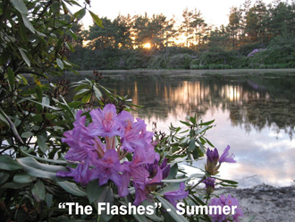
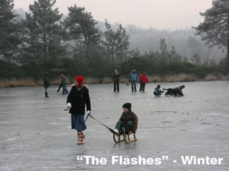
permissive bridleway on the right. This leads to "The Flashes" (a name given to
two small ponds) area of heathland. A sandy but rideable trail
.JPG)
(look out for side trails bypassing sandy areas) brings you eventually to a
three way
junction at the foot of The Devils Jumps. Turn left and as the bridleway
narrows and becomes deep sand take a narrow side trail to the right. Continue
to the end of this avoiding wider turnings to right and left and rejoin the
bridleway at a point where it again becomes rideable. The larger of The Flashes
is immediately on your left. After very wet weather it is better to look for a
narrow trail between bushes on your left which takes you past "The Flashes" as
the bridleway can become completely "horsed out" in winter.
Continue slightly uphill to a T junction with
Sandy Lane.
Turn left here, cross a small stream (bridge or ford) then turn left onto a
bridleway. At a T junction bear left then after a few meters a very nice single
track forks to the
right. This rejoins the sandy bridleway shortly before a four way junction.
Take the right turn where a loose but easily rideable climb brings you to the
southern end of Kings Ridge. A section through trees with the possibility of
muddy sections, which can be bypassed, brings you back to the start of this
description of the ride.
Return to home page
|
START POINTS
FRENSHAM LITTLE POND. From the small car park at the
corner of Priory Lane on the right from the direction of Frensham.
Ride up the byway leading from the car park until the brow of the hill. Turn
right and ascend to the top of "Kings Ridge". Continue along Kings Ridge
until there is a short trail on your right. Ride across to the other side of
the ridge where a right turn puts you on the described route just after the left
fork mentioned at the start.
If that car park is full (can be busy at weekends and in the "after school run"
dog walking period) there
is a trail at the back of the main car park where a right turn brings you to
the Priory lane one.
FRENSHAM GREAT POND CAR PARK: Exit car park and turn left on the road then
follow the route as described.
Start From Here
ROWLEDGE CHURCH CAR PARK: There is a small car park at St James Church in
Rowlege. From the back of the car park a trail goes straight to the Alice Holt
Cycle Trail. Turn right and follow the trail as described.
Start From Here
ALICE HOLT CAR PARK. You will have to pay to park here. The entrance is off of
Dockenfield Street, Bucks Horn Oak. You can head straight for The Shipwrights
Way and follow the cycle trail at the end.
Start From Here
|