About this ride.
Approx 12 miles. This ride passes through some interesting and historical areas
and has only one short, easily bypassed "extreme" section, so is suitable for
anyone with reasonable fitness and bike skills. There is the opportunity to
explore more demanding sections in Bourne Woods and Hankley Common.
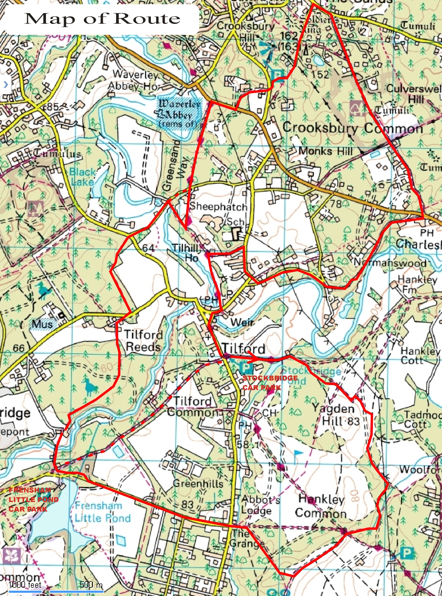
Map of Route
Return to home page
|
Starting from Stockbridge car park, the full route is accessed by turning
right.
You can miss out the Hankley Common section by crossing the Tilford Road and
following the byway opposite for about a mile to where the main route crosses
it just before
FRENSHAM LITTLE POND CAR PARK.
Continue on the full route by following the byway (the same side of the road as
the car park) on a gentle descent, passing Stockbridge Pond and arriving at a
gate onto Hankley Common.
.JPG)
.JPG)
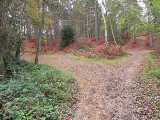
The trail shortly divides three ways. Take the right
trail but a more interesting alternative to following it straight up the gulley
is to
take a single track ascending around the end of the bank to your right.
.JPG)
Follow
the single track until it meets the main trail again and turn right onto it,
then take the left fork. There are side trails here to miss flooded sections in
wet weather. Keep to the main hard trail ignoring a sandy turnoff until it
meets a T junction. Turn left here skirting the virtually permanent puddle and
follow the trail to the right.
.JPG)
.JPG)
Where the trail ascends gently as a sandy
bridleway (difficult in dry periods), look out for a narrow single track
running parallel to its right. Then stay on the main trail, ignoring a sandy
track to your right until the trail forks.
.JPG)
.JPG)
Take the left fork which ascends
then drops down an interesting gully with a nice display of heather on its
banks in summer. At the bottom, again ignore sandy trail to your right and
shortly you will come to a fork with a green triangle.
.JPG)
.JPG)
Take the right fork then
continue keeping to your right through forest. There can be some fairly deep
sand so keep by the trees to the right and you will emerge onto the bridleway
from a gully.
.JPG)
Turn right and continue on the main trail which bears to the left, ignoring
turnings to
the right. This area is known as The Lion's Mouth and there is an interesting
feature from WW2 to your right,
The Atlantic Wall
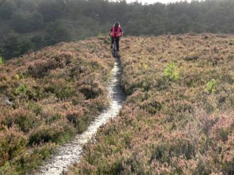
. After a moderate ascent you will arrive on Hankley Ridge. The main bridleway
continues to the right but if you cross to the edge of the "bowl" there is an
interesting single track giving a fine view of the common below and re-joining
the bridleway after a few hundred meters.
.JPG)
Follow this wide firm trail along the
top of the ridge for a short distance then take the second trail to your right.
Bear right then left (staggered X roads). The trail shortly descends to another
cross roads. Turn right onto a wide trail which descends to a gate to exit
Hankley Common. Cross "Tilford Road" into "Grange Road" and continue for about
half a mile,
then just before the road descends to a ford and treacherously slippery wooden
bridge, turn right onto a bridleway running parallel to the road, ignoring a
driveway immediately to your right.
This interesting single track shortly
crosses the byway from Stockbridge, passing close to
FRENSHAM LITTLE POND CAR
PARK. Cross Straight over
(Left if coming from car park, right from the short cut)
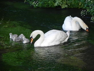
Bear right and descend to a bridge crossing the River Wey at Tankersford
(Tancred's ford, you may see swans here).
.JPG)
Continue through
Pierrepoint Farm
, owned by
The Countryside Restoration Trust
.JPG)
Pass through a gate where a short ascent on single track brings you to a wider
trail with some interesting side trails. Look out for one on the left on a
descent just before it leads into a driveway which then ascends to the Tilford
to Frensham road, "Reeds Road".
.JPG)
.JPG)
Cross over Reeds Road into another bridleway. You will pass Bourne Woods on
your left where many of the major films are produced. If you would like to try
some more demanding hills look out for gates on your left where you can explore
the Bourne Woods trails. The trail descends to the Tilford to Farnham Road.
.JPG)
.JPG)
Cross straight over into Sheephatch Lane. Just after a bridge over a branch of
the River Wey, a bridleway can be accessed on your right. Although
rideable by more adept riders it is a steep climb through a narrow gulley and
is the most demanding section of the route.
.JPG)
.JPG)
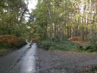
To bypass this continue on Sheephatch Lane through "Sheephatch Hollow", an
interesting "tunnel" like road climb. At the top join the described route by
turning left into the byway described below.
At the top of the ascent continue on the main trail until a T junction with a
byway. Turn left here. The trail becomes a driveway passing Sheephatch Farm and
meets Sheephatch Lane again at the top of the "hollow".
.JPG)
.JPG)
Cross straight over
into another byway. After a descent through an off road hollow, bear left
(Waverley Abbey ruins can be glimpsed through the trees to your left) and
continue to a junction with the Farnham to Elstead road.
.JPG)
.JPG)
If you have time there
are some interesting diversions to your left.
Waverley Abbey Ruins
,
Mother Luglam's Cave
and the excellent lane to Farnham which was once disputed in
The Battle of Moor Park
. Now downgraded to footpath but used mainly by bikes.
Our route turns right here and ascends on the road, then shortly into a
bridleway on the left giving access to a couple of houses.
.JPG)
.JPG)
At it's junction
with Crooksbury Road, cross straight over into a single track bridleway which
winds through woods at the foot of Crooksbury Hill.
.JPG)
.JPG)
Turn left onto Smugglers Way", a byway, at a three way junction ignoring the
footpath to your left.
.JPG)
The byway ascends until it becomes a surfaced access road. Continue to the T
junction with Littleworth Road beside The Jolly Farmer pub at Seale. Turn right
and soon take another right into Long Hill, an access road which is also a
bridleway.
.JPG)
At the end of the surfaced road the trail continues as as gentle
sandy descent across Crooksbury Common. At a barrier continue straight on where
the road descends passing some very interesting old houses constructed from
stone from Waverley Abbey.
.JPG)
.JPG)
.JPG)
.JPG)
The trail terminates at a junction with the Elstead to Farnham Road at the foot
of "Charles Hill" (mentioned in Cobbett's Rural Rides as having a fine view of
Hindhead but now heavily wooded). Cross straight over to The Donkey pub and
follow the byway that runs past it until it meets a hairpin turn in Whitmead
Lane, Tilford.
.JPG)
.JPG)
Continue straight on Whitmead Lane which descends then climbs
quite steeply. At the top of the climb fork right to a T junction with Tilford
Street.
.JPG)
.JPG)
Turn right and after passing Riversmeet and Shepherds Way take the next
left into Squires Hill Lane by a green triangle. Look out for a bridleway on
your left known locally as "The Grove".
.JPG)
.JPG)
This descends to the river at Tilford.
There is a drop off (fun if you know it's there) and views across the river
meadows to Tilford.
.JPG)
.JPG)
Cross the bridge and turn left. The road climbs gently beside Tilford Green
.JPG)
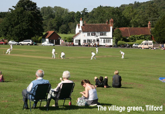
then bears left passing Tilford Church on your right. Shortly after the road
levels a byway crosses the road.
.JPG)
STOCKBRIDGE CAR PARK is on your left. If you
started from Frensham Little Pond turn left to Hankley Common or right to
shortcut the route.
|
START POINTS
STOCKBRIDGE CAR PARK - is located just south of Tilford Green on Tilford Road.
Heading towards Hindhead, look out for a byway crossing the road soon after the
brow of the hill. Car park is on the left.
FRENSHAM LITTLE POND CAR PARK - is located on Priory lane, on the left heading
towards Hindhead on the Farnham to Hindhead road (A287) just after crossing the
river. Pass the small car park on a sharp corner and the main car park is on
the right. Ride out of the entrance, turn right and immediately left into a
byway. The described route starts by turning left into a bridleway after about
50 meters.
Start From Here
|